Every site has a story to tell

Archaeological surveys for the research, commercial, and community sectors

Operating independently for over 8 years we have grown to become the largest provider of Archaeological Geophysics surveys in the UK.

Our areas of expertise

As we design, manufacture and utilise our own bespoke geophysical systems and software, we offer tailored geophysical surveys to meet any project’s specific geophysical requirements and any other needs.

Surveying an abbey

Archaeological Surveys

As heritage specialists and a CIfA member organisation, we can design and deliver a geophysical survey programme tailored to the specific aims, objectives and needs of your heritage project.

Environmental Geophysics

Skilled in a wide range of near-surface geophysical survey techniques, we can provide geophysical services to address a variety of targeted environmental questions.
A man on a quad bike in a field

What we offer

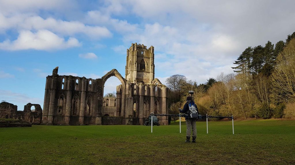
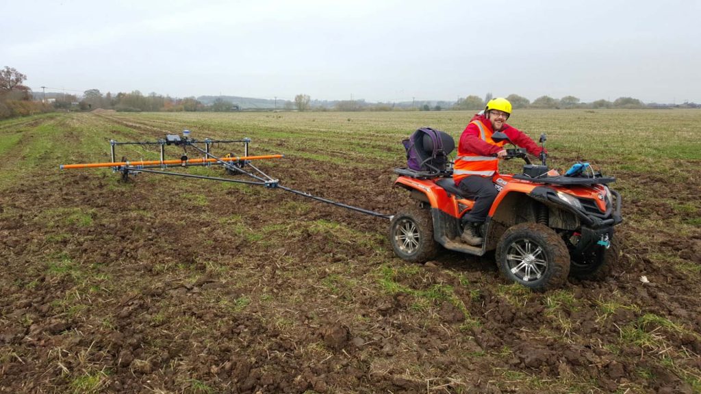
Offering a full suite of  geophysical and remote sensing survey techniques across the UK and beyond. We are the largest independent provider of Archaeological Geophysical surveys in the UK. We design, manufacture and utilise our own bespoke geophysical systems and software, allowing us to tailor geophysical surveys to meet any project’s specific requirements.

Independent Advice

Employing experts in archaeological, geophysical and aerial survey techniques we will provide you with unbiased advice, from planning through to completion.

Tailored Surveys

There is no “one size fits all” approach for geophysical survey. We will ensure you are provided a survey package most appropriate for your site, programme and budget.

Training

We offer a full in house training programme on all aspects of Archaeological Geophysics. We can adapt this for community and educational projects to suit all ages.

Latest news

Read the latest updates from the Magnitude Surveys team.

Staff Halloween Party 2023

MacMillan Coffee Afternoon

Our techniques

We are skilled at collecting, processing and visualising a range of geophysical techniques. This allows us flexibility in designing a survey strategy tailored to your needs and the site environment.

Aerial Photography and Videography

Aerial views provide unique, breath-taking perspectives, capturing assets, sites and landscapes as images, videos or photospheres. Perfect for reconnaissance surveys, settings assessments or promotional campaigns.

Aerial Reconnaissance

Incorporating aerial imaging during ‘walkover’ surveys extends the visual range of the surveyor, allowing reconnaissance to be carried out more safely and efficiently, with vastly more informative visual outputs.

Hectares Surveyed

Number of Staff

Projects last Year

Counties Surveyed

Our clients

Lorem ipsum dolor sit amet, consectetur adipiscing elit, sed do eiusmod tempor incididunt ut labore et dolore magna aliqua.

Get a quote

Tell us about your project and we’ll let you know how we can help.

Accreditations